AERIAL PHOTOGRAPHY
Drone Aerial Photography
From Above
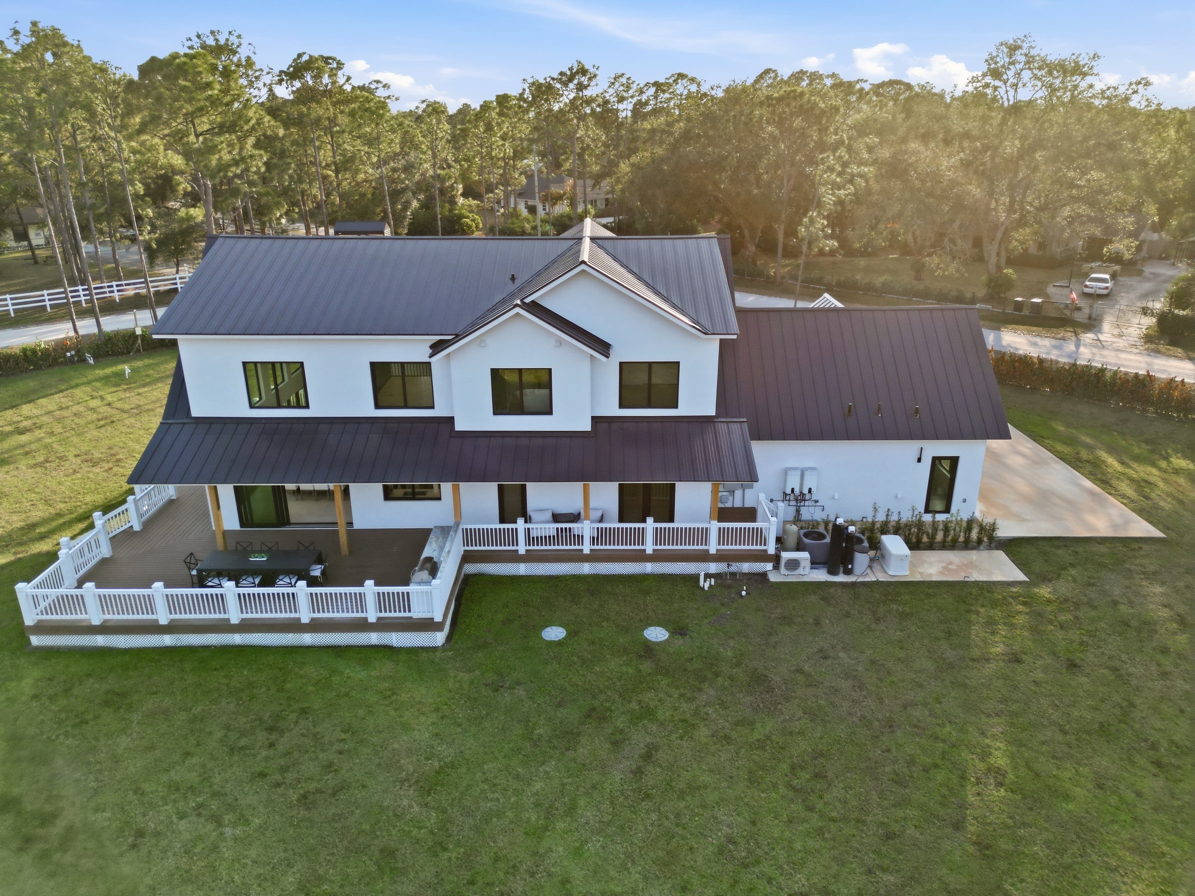
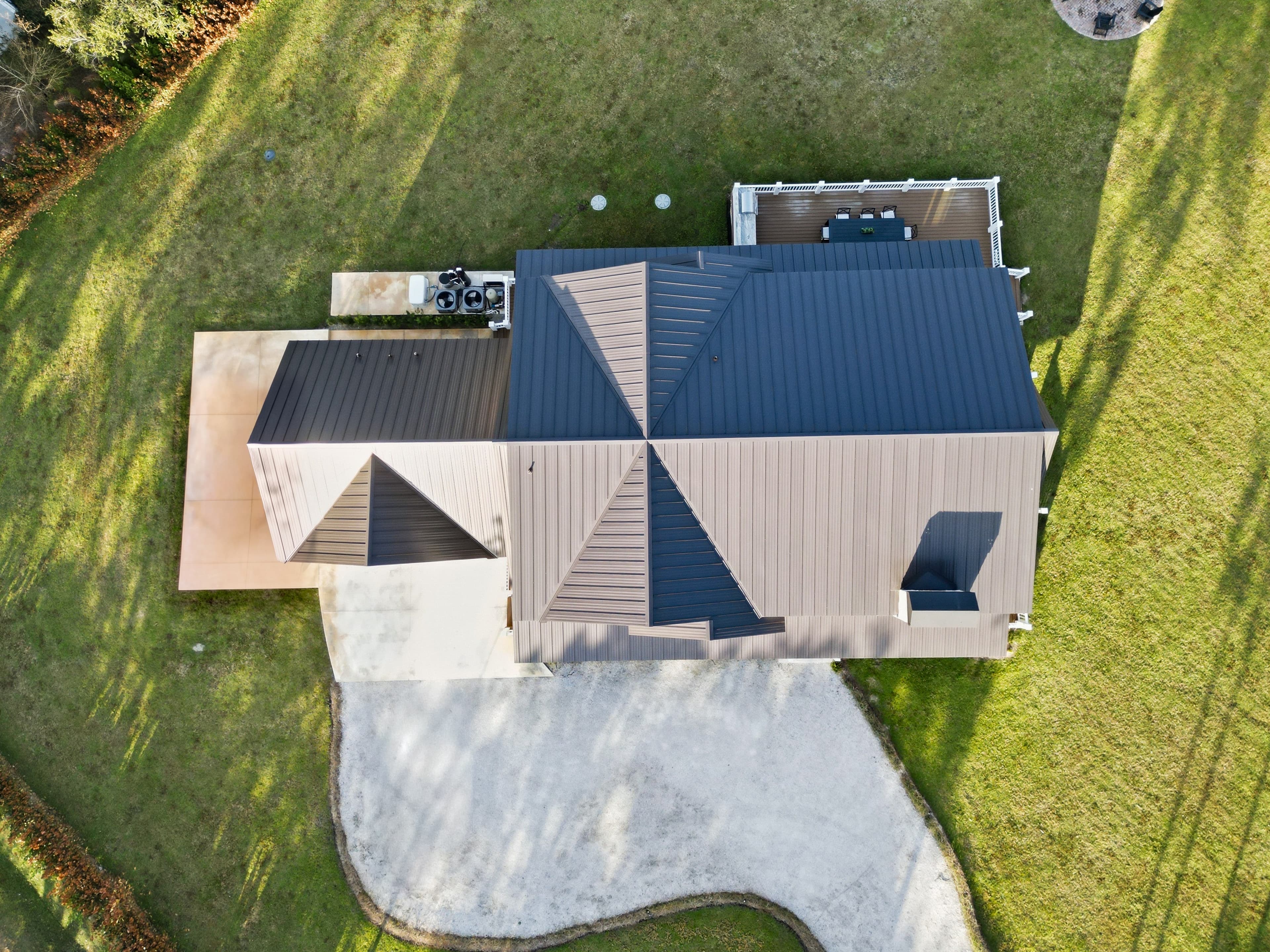
FAA-certified drone aerial photography that showcases your properties from unique perspectives. Capture stunning views of waterfront features, large lots, architectural details, and surrounding neighborhoods that ground-level photos simply can't match.
Why Drone Aerial Photography Matters
In South Florida's competitive real estate market, aerial photography has become essential for showcasing properties effectively. Drone shots provide buyers with a complete understanding of a property's location, size, and unique features that simply aren't visible from the ground.
Aerial photography is particularly valuable for waterfront properties, estates with large lots, golf course communities, and properties with unique architectural features. These elevated perspectives help potential buyers visualize the property's relationship to its surroundings and understand the full scope of what they're purchasing.
Studies show that listings with aerial photography receive significantly more views and sell faster than those without. In a market where first impressions are everything, professional drone photography gives your listings a competitive edge.
What We Capture
Our FAA-certified drone pilots capture comprehensive aerial views that showcase every aspect of your property.
Property Overview
Complete aerial views showing the entire property, lot size, and building footprint from multiple angles.
Waterfront Features
Stunning views of ocean access, canals, lakes, and waterfront positioning that highlight premium location features.
Neighborhood Context
Aerial perspectives showing proximity to beaches, golf courses, shopping, and other desirable amenities.
Architectural Details
Close-up aerial shots highlighting roof design, landscaping, pools, patios, and unique architectural elements.
Lot Size & Layout
Clear visualization of property boundaries, lot dimensions, and how the home sits on the land.
Golden Hour Shots
Beautiful sunset and golden hour aerial photography that adds warmth and luxury appeal to your listings.
FAA-Certified & Fully Insured
All of our drone operations are conducted by FAA Part 107 certified pilots with full commercial drone insurance. We maintain strict compliance with all federal aviation regulations and local flight restrictions.
Safety is our top priority. We conduct thorough pre-flight checks, monitor weather conditions, and follow all airspace restrictions. Our pilots are trained in emergency procedures and maintain current certifications.
We carry comprehensive liability insurance specifically for commercial drone operations, giving you peace of mind knowing your property and surrounding areas are fully protected during aerial photography sessions.
Perfect For These Properties
Aerial photography is especially valuable for certain types of properties in South Florida.
Waterfront Properties
Oceanfront, canal-front, and lakefront homes benefit tremendously from aerial views that showcase water access and positioning.
Large Estates
Properties with extensive grounds, multiple structures, or significant acreage need aerial photography to show the full scope.
Golf Course Homes
Aerial shots highlight proximity to fairways, greens, and the overall golf course community layout.
Luxury Condos
High-rise and mid-rise condominiums use aerial photography to show building architecture, amenities, and location advantages.
New Construction
Aerial photography helps showcase the building site, surrounding development, and future potential of the area.
Commercial Properties
Office buildings, retail centers, and commercial developments use aerial shots to show location, parking, and accessibility.
Rental Properties
Vacation rentals and investment properties use aerial photography to highlight proximity to beaches, attractions, and amenities.
Land & Lots
Vacant land and building lots require aerial photography to show boundaries, topography, and development potential.
How It Works
Our streamlined process ensures you get stunning aerial photography with minimal disruption.
Pre-Flight Planning
We review weather conditions, airspace restrictions, and property details to plan the optimal flight path and angles.
Aerial Capture
Our FAA-certified pilot conducts the flight, capturing multiple angles, elevations, and perspectives of your property.
Professional Editing
We edit and enhance your aerial photos with color correction, exposure balancing, and professional finishing touches.
Ready to Elevate Your Listings with Aerial Photography?
Book a drone aerial photography session today and see how stunning aerial views can help your properties stand out in South Florida's competitive real estate market.